Showing posts with label South Sound. Show all posts

Monday, October 24, 2011

Destination: Olympia

If you arrived here by searching for a chart or charts, please see this page.

The city and port of Olympia lies at the far southern end of Budd Inlet, and is the furthest south you can travel on water in Puget Sound.  Olympia is the capitol of the State of Washington, and as it is an historic place, it would be appropriate to add a little historical perspective here.

In 1792 George Vancouver sailed into the Strait of Juan de Fuca to begin to chart the area, and to seek the western entrance of the fabled Northwest Passage.  Tho it is difficult, one must keep in mind the gap in settlement between the East Coast and Puget Sound at this time.  In the east, the Revolutionary war had been fought and won, the Constitution which defines our government had been crafted, and things were bustling.  Out West, Vancouver and his Lieutenant Peter Puget had just started exploring the waterways that would be called "Puget's Sound".  (While on his journey of discovery, Vancouver encountered the Spanish ships of Dionisio Alcalá Galiano, who was on a similar mission. This is the explanation for the strange mix of Spanish names {Sucia, Galiano, Patos, Matia, Texada} and English names in the area.)

Several days sailing from the open sea, but close to the terminus of the Oregon Trail, the settlement of Puget's Sound began from its southern end and proceeded northward.  The city of Olympia was founded early-on in 1859, eight years after the U.S. Congress established the Customs District of Puget Sound for Washington Territory there.

Approach to Olympia
Excerpt from chart 18456
Depths in feet
Modern-day visitors to Olympia coming by water will proceed down the five-mile length of Budd Inlet, the capitol dome in view the entire time.  It will pay to tend to the West, toward the starboard shore, as the entrance to the dredged channel is not in the center of the Inlet but close-on to the western shore.  This course will also keep you away from Olympia Shoal.  The entrance to the dredged channel is well marked.

Proceed down the channel in a generally southwesterly direction; there are range boards (and lights) to keep you on course.  But note that there are no range boards for the outbound trip, so keep your trip log on your GPS and pay attention to your depth sounder.

Port of Olympia
Excerpt from chart 18456
Depths in feet
The channel forks at its southwesterly end, with one branch going into East Bay, and one branch going to West Bay, where the capitol dome is located.    (When we made the trip in 2011, we chose to go into West Bay, so the rest of this post will deal with West Bay.)  The buoyage at the fork can be a little confusing for the first-time visitor, so proceed with caution until things "click" for you visually. 

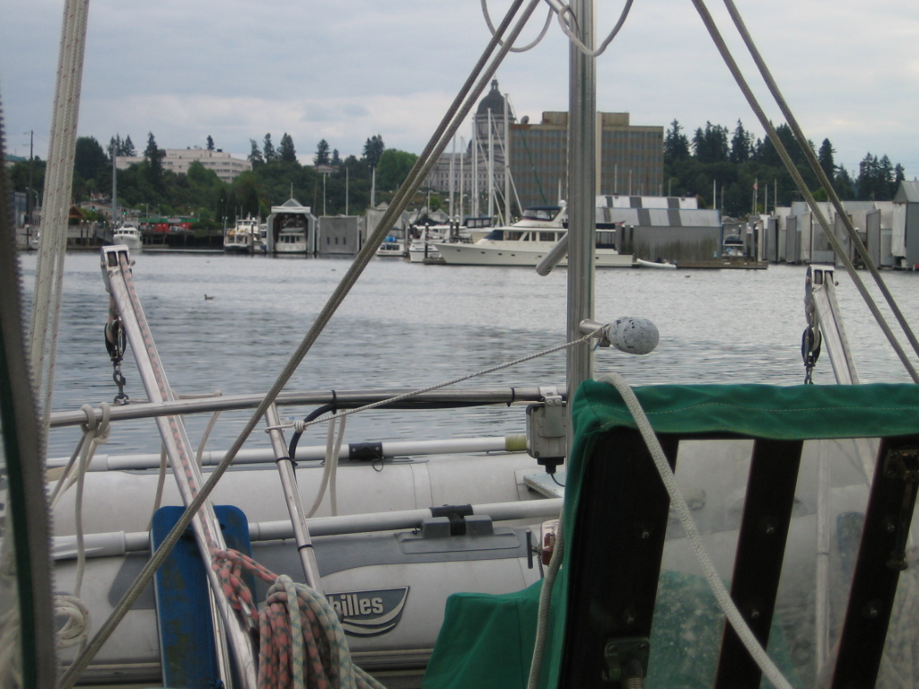
Proceed down past the huge commercial wharf, out of the turning basin.  There is plenty of good anchorage on a mud bottom below the buoys marking its boundary.  The commercial wharf is in active use - when we were there it was packed with a huge mountain of raw logs being readied for shipment, presumably overseas to be milled into metric lumber.  When I say "active use", I mean 24 hours/day.  So anchoring closer to the head of the bay would provide a quieter nite's rest.

Percival Landing is a community dock just below the turning basin, on the east side of the bay.  This is available for day moorage (free for less than 4 hr) or overnight for fee (there is no electrical or water hookup).  It provides easy access to all the amenities on the east shore, including the Anthony's restaurant where we enjoyed dinner, looking out at our boat at anchor.

A quick dinghy trip across the bay to Tugboat Annie's is a pilgrimage for many, and our neighbors highly recommend the farmers' market.

And of course, wherever you are in West Bay, the capitol dome dominates the view.
Share/Bookmark

Monday, October 17, 2011

Destination: Boston Harbor

If you arrived here by searching for a chart or charts, please see this page.

Excerpt from chart 18456
Depths in feet
At the far Northeast end of Budd Inlet (see chart 18456, or page C or 18445), just above Dofflemeyer Point, lies Boston Harbor.  There are no tricks or cautions in approaching Boston Harbor, however it should be noted that a fair tidal current runs here.  There is a nice protected anchorage with a good mud bottom, but when we visited in the summer of 2011, that anchorage was filled with mooring buoys*, many of which were not in use.  Despite the shallow depths, and the attendant short scope, we could not find a place to drop the hook in the inner harbor, relegating us to the area out near the line of orange/white "No Wake" buoys marking the outer perimeter.  There was more current out here, but it was still a good anchorage.

There is a small marina in Boston Harbor; when we visited, we ended up at the marina for breakfast.  This is a delightfully random place.  It reminds me of some of the stores we saw in Desolation Sound - over a friendly uneven floor they sell beer, ice, boots, gifts, food, clothes, books, chandlery, fresh seafood, and more that I have forgotten.  And it seems that the marina is the social center of the area.  I would guess that summer Saturday nites are lively here.

After breakfast, we took a walk around the harbor.  The housing was a delightful mix of old beach cabins, new housing, and a refreshing absence of the trophy houses that seem to be cropping up everywhere on the waterfront, despite the fact that Boston Harbor is less than 10 miles by road from the state capitol.

* Is it just me, or does it seem that Puget Sound anchorages are filling up with mooring buoys?  Most seem to be unused or abandoned.  Also, I know for a fact that some shoreline property owners place buoys specifically to prevent cruisers from anchoring in "their" view.
Share/Bookmark

Monday, September 19, 2011

Double anchor, double kudos

Friday, Sept 16 and Saturday Sept 17
(delayed due to sparse internet connectivity in the South Sound)

On an out-and-back trip, one of the problems is that the return trip can be kind of anti-climatic.  As soon as you turn around, you are in territory you covered only a little while ago, and there is a mixture of the beginnings of nostalgia and the undeniable draw of home.  We try to minimize this by stopping in alternate places where possible.  But portions of the trip are inevitably repeats.  Nevertheless, with the wind as propulsion, it is unlikely that both the outbound and inbound legs will be identical. 

We rose early again (rats!) and motored out of Filucy Bay ("wind as propulsion"?  not on this leg), heading for Gig Harbor once again.  It was a strangely uneventful trip...  We only saw three other boats in the entire distance:  the strange part was that these were three Canadian military vessels (#60, #61, #62).  We met them as they traversed Balch Passage, and we speculated that perhaps Olympia was about to be invaded by Canada.

A view of the Tacoma Narrows
bridges that most will never see
Passing under the (now dual!) span of the Tacoma Narrows bridge is always a rush - literally a rush if you do it properly, with the tide. 

We moved to the back of the harbor in Gig Harbor once again, in about the same place we had been a few days prior.  Tho the depth shown on the chart was a uniform 23 feet, as we drifted back and forth on the anchor, we occasionally saw depths of 14 feet.  I joked that perhaps there was a wreck down there.

It was a pretty evening and nite, and I experimented again with long-exposure pictures.  Normally I would have discarded this one, but something in the colors and shapes interested me, in an abstract sort of way.

Next morning: final, or final but one leg.  The wind forecast for Monday was for 20-25 kt at Shilshole, and I didn't really want to dock in that much wind.  So we hoped to use Sunday's 10-15 kt southerlies as travelling wind and get tied to the dock ahead of the big blow.


The first setback occurred as we hoisted anchor.  I was down in the bow, flaking the chain as it came aboard as usual.  I noticed that the windless seemed to be running unusually slow...  and then Jane called me up topside.  Uh oh.  There really was something down there.  Tho I can't say for certain if there was a wreck, there was certainly an abandoned old-fashioned anchor and its rode.  Kudos to our windless for being able to hoist this mess up to the surface where it could be dealt with!

The time-honored way to clean up this situation is to pass a line under the offending object, securing both ends on deck.  Then you lower your anchor, away from the now-suspended object.  In the picture I have started reeving the line.  The procedure worked for us (the second time we have had to do it), and the old anchor is back on the bottom of Gig Harbor.  It would have made a really neat souvenir, except that we really had no way to carry a very heavy and very rust-corroded object.  If anyone is interested, I can forward approximate coordinates - it would be good to get it out of the harbor.

We motored most of the way up Colvos Passage, with the current at our back.  Near the north end, the beginnings of a travelling wind appeared and we unrolled the yankee for a downwind run to Shilshole.

Unfortunately, by the time we reached West Point, we were seeing 20+ kt at our backs while making 7+ kts.  We briefly discussed running off to Port Madison and anchoring to wait it out.  But the forecast was for more (perhaps much more) of the same.  West Point partially shelters the Marina and the breakwater adds some protection.  We decided to explore and see how bad it was right at our slip - with the option to bail and head to Port Madison if it was bad.  Jane called Angela on the phone, and she rallied up a crew on the dock.

Things seemed tenable as I turned into the waterway, and so I committed to docking.  All went well until the boat was halfway into the slip.  Then a BIG gust hit us broadside, slamming us into the corner of the finger.  Kudos to Angela and our good friends and neighbors for saving us!  We already had one line ashore at that point - that meant that the bow could be kept under control; the rest of the crew fended off and took the other three lines.  No damage, thanks to all the help!

Tied to a dock again, for the first time since Sept 9... and the beer never tasted so good!
Share/Bookmark

Sunday, September 18, 2011

Filucy Bay Leaves

Thursday, Sept 15
(delayed due to sparse internet connectivity in the South Sound)

We rose pretty early and bid adieu to Olympia.  Early because we are now northbound, and the ebb tides are in the morning right now.  Up until today we have been very genteel with our cruising - the tides have dictated (!) that we not leave our anchorages until afternoon.

We threaded the needle back out the long dredged channel (note: Tho there were for the inbound course, there are NO range boards* for the outbound course - thank heavens for our GPS!), back out past Boston Harbor, and into Dana Passage.  About 2/3 of the way thru Dana Passage, the wind picked up enough that we could kill the engine.

For the rest of the morning, we quietly sailed, anchoring about 15:00 in Filucy Bay.  (Do you say Fil-u-see or Fil-u-she?  Those locals we have asked called it Fil-u-see.  I always go with the locals.)

Filucy Bay is special because Ken's parents (Jeff and Sue) have a beach house there, and as it turned out they were at home.  We shared dinner with them and had a nice long chat, until way after dark.  Motoring back out the boat in the dark was a really cool experience - the phosphorescence was spectacular - the discharge from the prop of the outboard looked like a pale blue searchlight pointing astern underwater, and each of the two tubes of the dinghy trailed a smaller beam.  There is no possible way to make a picture of this, unfortunately.  You will just have to go out on the water with us at nite if you want to see it.

The final bit:  Sue gave us a big bunch of bay leaves from their plantings.  Aside from their obvious use as a seasoning, we use them to repel weevils in the floury things on the boat.  We even leave some just laying around on the  pantry shelves, just in case.  It really works!


* Range boards are two boards, spaced our both horizontally and vertically, each with a stripe.  They are positioned such that if you line the two stripes up one above the other and keep them there, your course is the desired one.
Share/Bookmark

Saturday, September 17, 2011

On to Olympia

Wednesday, Sept 14

This morning we took a harbor tour of Boston Harbor, and ended up at the Boston Harbor Marina for breakfast.  This is a delightfully random place.  It reminds me of some of the stores we saw in Desolation Sound - over a friendly uneven floor they sell beer, ice, boots, gifts, food, clothes, books, chandlery, fresh seafood, and more that I have forgotten.

Later, I put the final coat of varnish on the port caprail and pulled the tape (cruising = working on your boat in exotic ports).  Then we relaxed until mid-afternoon when we hoisted anchor and motored off for Olympia at the south end of Budd Inlet.  This is the southernmost anchorage in the South Sound, and is also, completely coincidently, the capitol of the State of Washington.  In fact, as soon as we turned left into Budd Inlet proper, the capitol dome was visible in the distance.

It's a little tricky getting down to the far end of Budd Inlet - you must traverse a long dredged channel (35' deep; 3' deep on either side), but there are range boards, and the GPS is definitely your friend for the passage.  We ended up anchoring right in front of the Anthony's restaurant, and virtually under the capitol dome.

When you anchor directly in front of Anthony's, you must, of course, eat there.  We had a great dinner, and enjoyed watching Eolian resting peacefully while we munched on northwest seafood cuisine.

The capitol dome is illuminated at nite.  This is pretty neat, but they do turn off the lights later in the evening, presumably to save us taxpayers some money.

But the huge yard filled with logs waiting to be loaded onto a ship was also illuminated, and the work there continued all nite.  This did not contribute to my personal sawing of logs.


Share/Bookmark

Friday, September 16, 2011

Boston, but not in Massachusetts

Tuesday, Sept 13

For breakfast this morning I made cornbread.  Aside from the corny, yummy goodness, this provided cabin heat, which was welcome this morning.  The hot days of summer are over, and Autumn has fallen with a crash.  After breakfast we masked, sanded and got a coat of varnish on the port caprail.  And after lunch, we threaded the needle out of Vega Bay and drove the entire distance to Boston Harbor, over at the top of Budd Inlet (wind was non-existent).

This is a shallow bay (both in terms of the water depth, and the amount it intrudes into the coastline), and is not easy to anchor in.  We took a tour of the mooring field, looking for a spot that had perhaps been overlooked in the placing of mooring balls, but there just wasn't one.  So we ended up anchoring at the outside of the mooring field, well exposed to the pretty substantial current. 

Usually I am pretty good at picking a spot to drop the anchor, but here I failed; the current flowing thru the bay threw me off.  We ended up too close to a moored boat and had to move.  The second time I did better.  But still, we were unsure how things would sort out after the tide change.  So we set an alarm for 15 minutes before the change (01:00) and went to bed. 

Then in the middle of the night (it was a warm nite), we sat in the cockpit and watched the dance as moored boats and empty mooring balls rearranged themselves in response to the changing water flow.  Being on deck on a boat at nite in a quiet anchorage is like no other experience.  There were no waves, so I was able to take some very long exposures with my digital camera - up to 15 seconds.  These approximate the view that you actually see, but they don't convey the sound of gently lapping waves, a soft breeze, and the intense quiet.

As it turned out we were OK, and we gladly snuggled into our berths for the remainder of the nite.
Share/Bookmark

Wednesday, September 14, 2011

South Sound: alone

Alone in Vega Bay
Monday

One of the interesting things about boating in the South Sound is the dearth of boats here.  Compared to north of the Narrows, there are very, very few.

After spending a non-moving day at anchor in Gig Harbor, we are now at anchor in Vega Bay, one of the southernmost anchorages in the South Sound. There is no internet here, and tho there are two boats at anchor in the bay, they are unoccupied.

Yesterday in Gig Harbor, we shopped around in town, and bought some art (direct from the artist - how could we resist?), and had lunch at the Tides Tavern. We also finally got the long-sought ice cream and hamburger buns, at a small store across the road from Anthony's at the back of the harbor. Finding this store was a bonus, since the big QFC over by the Tides has closed up shop.

These were necessary items for the happy hour/dinner visit by the Maranto sisters, Breanna and Courtney (Fujita nee Maranto), and Aaron (who never stopped moving the entire time!  What a busy, curious little guy!). It was a fabulous afternoon, and thankfully we were on the water - it was just plain hot on land.

This morning, we motored out of Gig Harbor and the overcast into sunshine. After the always exhilarating ride down the Narrows with the tide, we raised sail.  The forecast southerly turned out to have enough west in it that we were able to sail close-hauled all the way to Vega bay. We flew the mizzen, main and staysail, but did not unfurl the jib. This made the rig completely self tending, so that tacking involved only turning the wheel. Call us lazy, if you wish.

And now we are here in Vega Bay, alone.
Share/Bookmark

Saturday, September 10, 2011

Decompression

Whew!

We are starting our decompression vacation following the wedding. Last nite we sailed to Eagle Harbor as the first stop on a South Puget Sound cruise (we have no planned itinerary - that's the way I like it).

I captured this picture of the Seattle skyline just as the setting sun gilded the skyscrapers with light - did I mention that the view from here is great?

Today, after a dinghy ride ashore for some last minute provisioning, we'll head down Colvos Passage to Gig Harbor - another lovely anchorage! Where do we go from there? Don't know. But we'll figure it out...
Share/Bookmark

Wednesday, June 29, 2011

Destination: Filucy Bay (Longbranch)

If you arrived here by searching for a chart or charts, please see this page.

South Puget Sound
Soundings in fathoms
(click for a larger version)
A favorite destination in the South Sound for many is Filucy Bay, located on the Southeastern corner of the Key Peninsula.  Many will refer to Filucy Bay by the name of the tiny town centrally located on it: Longbranch - most folks will use the names almost interchangeably.  Calling Longbranch a town is probably historically accurate, but tho it has a zip code, there is not much there beyond the marina of the same name.

To reach Filucy Bay, you will want to ride the tide thru the Tacoma Narrows (at the right in the chart).  Unless you are a power boat with a very large engine, you're going to want to make the Tacoma Narrows passage with the tide.  Probably you'll want to do so even if you have that large engine, because the tidal flow here can be prodigious.

After running the Narrows, you will continue to ride a lessening tide South, past Fox Island and then past the opening to Carr Inlet.

Filucy Bay
Soundings in fathoms
(click for a larger version)
Thread the needle thru Balch Passage, the narrow little run between McNeil Island on the North and Anderson Island on the South.  If the tide is still running strongly when you make this passage, do not get too close to Eagle Island - there can be a substantial current running to the South of Eagle Island which could drag you into very shallow water.  I almost ran us aground there.

You may have heard of McNeil Island.  It is the site of a maximum security Federal Prison.  There are signs all along the shore urging you to stay away and cautioning against picking up swimmers.  This is Washington's version of Alcatraz...  they do mean business.  Although the actual prison only occupies a small part of the island, the entire island is off limits, therefore much of it is in a wonderful natural state.

Do not attempt to approach Filucy Bay from the North thru Pitt Passage, between McNeil Island and the Key Peninsula without local knowledge.  Pitt Passage is shallow and littered with rocks.

As you enter Filucy Bay, occupying the Southern point which forms the opening you will see a beautifully sited large white estate - this is the aptly named "Faraway", built as a resort for the well-heeled in 1910, when it was indeed far away.  Today it serves as a retreat for the Archdiocese of Seattle.

The bulk of Filucy Bay is 8 fathoms, with a mud bottom.  It is an excellent, protected anchorage.   The water is warm; there is an oyster farm up the narrow part of the Northern arm of the bay.  And most unusual!  The bay is littered with sand dollars!  I had never seen them alive before visiting Filucy Bay.  In life they are covered with black, almost velvety waving hairs, and position themselves edge-on on a slant into the sand, looking for all the world like tiny crashed flying saucers.  Their skeletons (the traditional sand dollar) are everywhere.

Right in the middle of the West shoreline, almost directly across from the opening to the bay is the Longbranch Marina.  In 2010, a disagreement between the marina owners and Pierce County, which owns the wharf that serves the marina, as to who should maintain that wharf caused the wharf to be condemned by the County due to its disrepair.  But fear not, the disagreement has been settled and the wharf has been rebuilt - the marina is open!
Share/Bookmark

Friday, February 25, 2011

Destination: Cutts Island

If you arrived here by searching for a chart, please see this page.

Its been awhile since I did a Destinations post.  When last I did, we were working our way through the South Sound.  Today, we'll pick up where we left off, but first a little South Sound refresher...
The southern part of Puget sound has a very different feel than that portion north of the Tacoma Narrows.  In the South Sound, the waterways are narrower, the boat traffic seems smaller, and wonderfully, the water is warmer.  You will actually see boats pulling water skiers in the South Sound.  In fact, the water is warm enough for oysters to grow.
Now onward to today's destination... Cutts Island is located on the Eastern shore of Carr Inlet in the South Sound, about halfway up from the South.

South Puget Sound - excerpted from chart 18448

Cutts Island is a State Marine Park, and is conveniently just offshore from the land-based Kopachuck State Park.  This could serve as an excellent destination if you were meeting someone for a combined land-sea based vacation.  (Nearby Raft Island is private.)

Other than the usual timing issues with the Tacoma Narrows, there are no surprises in the approach to Cutts Island.  We like to anchor on the South side, because the tombolo stretching to the Northeast provides protection at all but high tide, making a nearly enclosed little harbor.

Cutts Island - excerpted from Chart 18448
Several State Park mooring buoys (Carl and Jo report 7) are present in the little bay, but there is plenty of room for anchorage too.  Surprisingly, it will not be difficult to catch an empty buoy if you arrive in the morning.  Our experience is that the buoys serve mostly day-use boaters.  Again, the cruising traffic in the South Sound is much lighter than you will expect.

Cutts Island itself is a small, steep-sided little island surrounded by sandy beaches, and with some brief hiking paths.  We found clamming to be excellent on all the beaches (always check for a red tide alert before clamming).

But the real party is out on the sandspit.  When it is exposed, it is a beach party/picnic place for folks with runabouts.  Although both sides of the tombolo had runabouts pulled up, the water skiers were courteous and did not ski on the South side, in the anchorage.

Cutts Island is the ideal summer anchorage - sun, sea, and sand, and lots of activity during the day.  But at night, things quiet down, the runabouts all go back to shore, and you are left with peace and quiet. 

And the next morning, be sure to rise early enough to soak up the beautiful horizon-spanning sunrise.
Share/Bookmark

Friday, December 3, 2010

Destination: McMicken Island

If you arrived here by searching for a chart, please see this page.

South Puget Sound - excerpted from chart 18448

The southern part of Puget sound has a very different feel than that portion north of the Tacoma Narrows (in the upper right of the chart above - click on the image for a full-sized version).  In the South Sound, the waterways are narrower, the boat traffic seems smaller, and wonderfully, the water is warmer.  You will actually see boats pulling water skiers in the South Sound.  In fact, the water is warm enough for oysters to grow.

Which brings us, in a way, to McMicken Island.  McMicken Island State Marine Park lies a little less than half way up Case Inlet, close on its western shore.  If you are coming from above the Narrows, you will want to time your passage thru the Narrows to take advantage of the substantial ride you will get from the tidal current.  In fact, the tidal ride will carry you well past the southern tip of Fox Island.  There are tide rips here, where the flow divides into a stream running up into Carr Inlet and one which continues South to the Nisqually Reach.  Tho it is always best to have the tide in your favor, it won't be all that much help to you once you round the southern tip of Anderson Island.

(soundings in fathoms)
The best anchorage at McMicken Island lies between the Island and the shore of Harstine Island, but do not try to reach the anchorage from the South.  There is a tombolo connecting the island to Harstine which drys at low tide.  Approach the little lagoon from the North.  The chart shows two state park buoys in the lagoon, but the last time we were there, there were at least 4.  You should survey the area while watching your depth sounder tho - the buoys were in pretty shallow water.   Depending on where the State Park has placed the buoys, we usually chose to anchor instead.  When the tide comes in, the tombolo is submerged, but the water over it is thin enough to damp the wave action, should there be any coming up from the South.

McMicken Island, looking East
The island itself is a delightful quiet little place; for us the most enjoyable part is walking in the shallows and looking for oysters (check the WADFW site for red tide warnings before harvesting).  Whether or not you find any of eating size, the walk along the shoreline is a wonderful passtime.  Be sure to tie your dinghy well - one time here ours drifted away on the incoming tide and I had to swim for it.

Looking  South, over the tombolo at low tide

Share/Bookmark

Tuesday, August 25, 2009

Destination: The Tacoma Narrows

If you arrived here by searching for a chart, please see this page.

The Tacoma Narrows are an amazing place. When you think of the huge quantity of water that has to move into and out of the entire South Sound, twice a day... all that water has to get there via the Narrows. Its no wonder that the tidal currents here are prodigious. Because the Narrows are after all, well... narrow.

This chart segment (depths in fathoms) shows that The Narrows are just South of Gig Harbor, and almost appear to be an extension of Colvos Passage, which extends to the North in the center of the chart segment. Depths are not a concern.

Tidal current, however, is. Unless it is a small tidal change, or unless you have a very large engine, you will not attempt to stem the tide here. But despite the magnitude of the current, there is very little turbulence (not at all like Deception Pass!) Transiting The Narrows is more like boating on a mile-wide river.

If you watch the locals, they will show you how to take maximum advantage of the higher speed flows within the general tidal current. Like canoeists in a river know, the maximum flow will always be at the outside of the bends in the river channel. So too for The Narrows. Our maximum speed-over-ground (as shown by GPS) so far is 13 kt in The Narrows... What's yours?

You will get to see the magnificent Tacoma Narrows Bridge from a unique perspective: sea level. Don't worry about clearance above your mast - there is plenty of room. Oh, and these pictures were taken in 2002 - before construction of the second span (that is, an entirely new bridge, right next to the old one).

I should point out that The Narrows funnels air flow as well as water flow. When the wind is up, it will really be up in The Narrows. For entertainment, check out some links to the first Tacoma Narrows bridge in the wind - an interesting study in resonance. Can you imagine the entire bridge span vibrating like a bowed violin string? It only lasted 4 months.
Share/Bookmark
Related Posts Plugin for WordPress, Blogger...